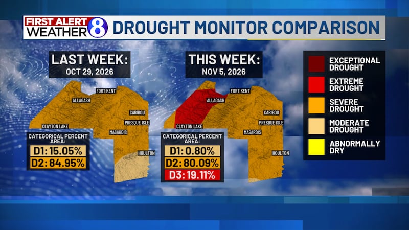
FIRST ALERT WEATHER: Sunshine Returns Thursday, With Weekend Storm Trending Farther South
PRESQUE ISLE, Maine (WAGM) - Good evening everyone and happy Wednesday. I hope everyone had a great Veterans Day, and a big thank you to all those who have served our country. We had another day of mostly cloudy skies across the region today, with a few rain and snow showers once again making their way across portions of Aroostook County. Skies look to clear out some overnight tonight, allowing temperatures to fall back well below freezing for most locations. Sunshine makes a return to the region tomorrow, with a few more clouds expected heading into the afternoon hours. One of the bigger changes to our forecast today has been with the storm system we’ve been watching for this weekend, with the latest trends suggesting the majority of the precipitation will remain well to our south.
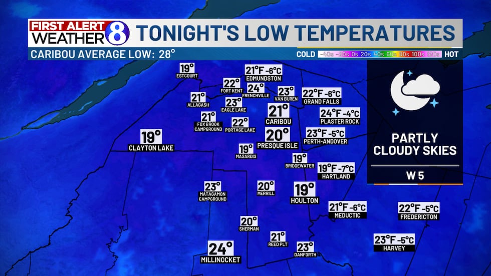
With cloud coverage decreasing heading into the overnight hours tonight, temperatures will have no problem cooling off into the upper teens and lower 20s for most locations. This will be a noticeably colder start to the day tomorrow compared to what we’ve seen the past couple of mornings. Winds are expected to remain fairly light overnight tonight, coming from a westerly direction around 5 mph. With the rain and snow showers we’ve seen over the past couple of days, I wouldn’t rule out a few slick spots on area roadways heading into tomorrow morning where any moisture remains on the pavement.
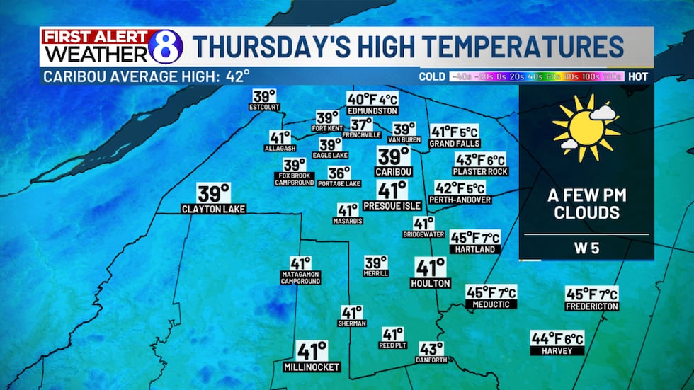
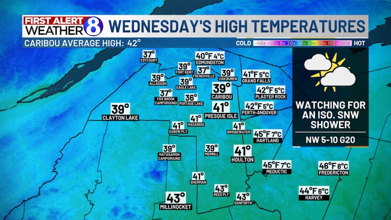
Tomorrow looks to be one of our nicer days weather-wise this week, with plenty of sunshine to start off the day. We’ll see some cloud coverage build back into the region heading into the afternoon hours, but I don’t expect it to ruin the day by any means. High temperatures tomorrow look to rebound into the upper 30s to lower 40s, which is right around where we should be for this time of year. Westerly winds remain light around 5 mph during the day tomorrow as well. If you have anything you need to get done outside, tomorrow would likely be the better of our next few days to do so.
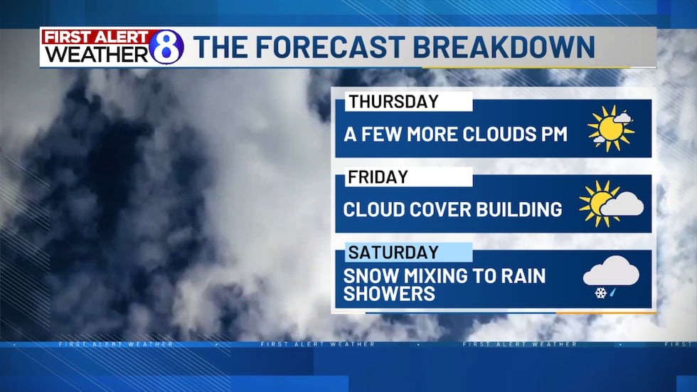
As we head into the end of the work week, we’ll see more cloud coverage build into the region Friday. Over the past couple of days we’ve been discussing the potential for a coastal storm to develop and bring our region some accumulating snowfall heading into the upcoming weekend. The latest forecast guidance has continued to shift this system farther to our south, which has resulted in some changes to my thinking for this weekend. At this point, it looks like the immediate Downeast Coast has the best chance of seeing any precipitation directly associated with this coastal storm, with the majority of Northern Maine looking to miss out. That being said, I don’t think we’re completely out of the woods in terms of seeing snowflakes this weekend. An area of low pressure in the upper levels of the atmosphere will still be making its way over the region, allowing for some additional shower activity to develop. I think our best opportunity for seeing some snow showers will be Friday night into Saturday morning, before temperatures warm back above freezing Saturday afternoon, allowing for more rain showers to mix in. I’m not expecting much in the way of accumulating snowfall at this point, which is a bit of a change from what we were discussing earlier this week.
Mostly cloudy skies are likely to stick around for the second half of the weekend, with temperatures remaining in the upper 30s to around 40 degrees. Unfortunately, with the latest trends in our forecast, it also looks like we’ll be missing out on another opportunity for some beneficial precipitation across Northern Maine. For more details on what to expect the remainder of the work week, along with the latest information on our weekend forecast, make sure to check out my First Alert Video Forecast attached to this article. Have a great evening!
Here’s the latest 8 Day Forecast from the NewsSource 8 First Alert Weather Team:

We launched First Alert Weather as a commitment to you! Read more about that effort here.
Download the WAGM First Alert Weather App on Apple or Android Devices, and get the First Alert to impacts in your town. The app is always Free to download!
Copyright 2026 WAGM. All rights reserved.